The Yellow River is known as Ma Chu in Tibetan, and Huang He in Chinese. The Yellow River basin is regarded as the cradle of northern Chinese civilizations and was the most prosperous region in early Chinese history. But also a source of devastating flooding which earned it another moniker: River of Sorrows.
After the Yangtse, the Yellow River is the second-longest river in China, and the sixth-longest in the world, with the estimated length of 5,464 kilometres. Originating in the Bayan Har Mountains in Amdo (Qinghai Province) on the Tibetan Plateau, the Yellow River flows through nine provinces of China and empties into the Bohai Sea. Well, theoretically. These days, it mostly fails to reach the sea—for upwards of two-thirds of the year.
Since 1972 when it first dried up, the river has dried up in its lower reaches (from Jinan to the sea)—in 1997 for 226 days. The low volume is due to increased agricultural irrigation—by a factor of five since 1950. Water diverted from the river as of 1999 served 140 million people and irrigated 74,000 km2 of land. The highest volume occurs during the rainy season, from July to October, when 60% of the annual volume of the river flows.
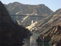
Damming and Diversion
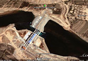
Zhiganglaka dam on Yellow River
Maximum demand for irrigation is needed between March and June. In order to capture excess water for use when needed, and for flood control and electricity generation, numerous dams have been built, but due to the high silt load their life is expected to be limited. A proposed South-North Water Transfer Project involves several schemes to divert water from the Yangtse River, one in Tibet at the western headwaters of the rivers where they are closest to one another, another from the upper reaches of the Han River, and a third using the route of the ancient Grand Canal.
Pollution
Why is it called the Yellow River? Because of the huge amounts of muddy silt that it carries: 1.6 billion tons of silt are carried annually at the point where it descends from the Loess Plateau. If it is running to the sea with sufficient volume, 1.4 billion tons of silt are carried to the sea annually.
But new discolouration is being provided in modern times: silt and mud are not all that is being carried along by the Yellow River. According to Wikipedia, on 25 November 2008 Tania Branigan of the guardian.co.uk, filed a report China's Mother River, the Yellow River, claiming that severe pollution has made one-third of China's Yellow River unusable even for agricultural or industrial use, due to factory discharges and sewage from fast-expanding cities. In 2007, the Yellow River Conservancy Committee surveyed more than 8,384 miles of the river and found that over 33% of the river system registered worse than Level Five. According to criteria used by the UN Environment Program, Level Five is unfit for drinking, aquaculture, industrial use and even agriculture. The report said waste and sewage discharged into the system last year totaled 4.29 billion tonnes. Industry and manufacturing made up 70% of the discharge into the river, with households accounting for 23% and just over 6% coming from other sources.
There is a saying in Chinese about something happening 'when the Yellow River runs clear'—not any time soon. The saying is on a par with the English expression 'when pigs fly'. Strangely enough, there is a bottled beer in China bearing the brandname Huang He (Yellow River beer). What were the makers of this beer thinking when they called it that? Hopefully, the water for this beer is not sourced from the Yellow River. The brandname even sounds like a joke in English.
If you want to see what a clean Yellow River looks like, you would have to go close to the source in the Tibetan highlands, where the river runs a milder shade of blue.
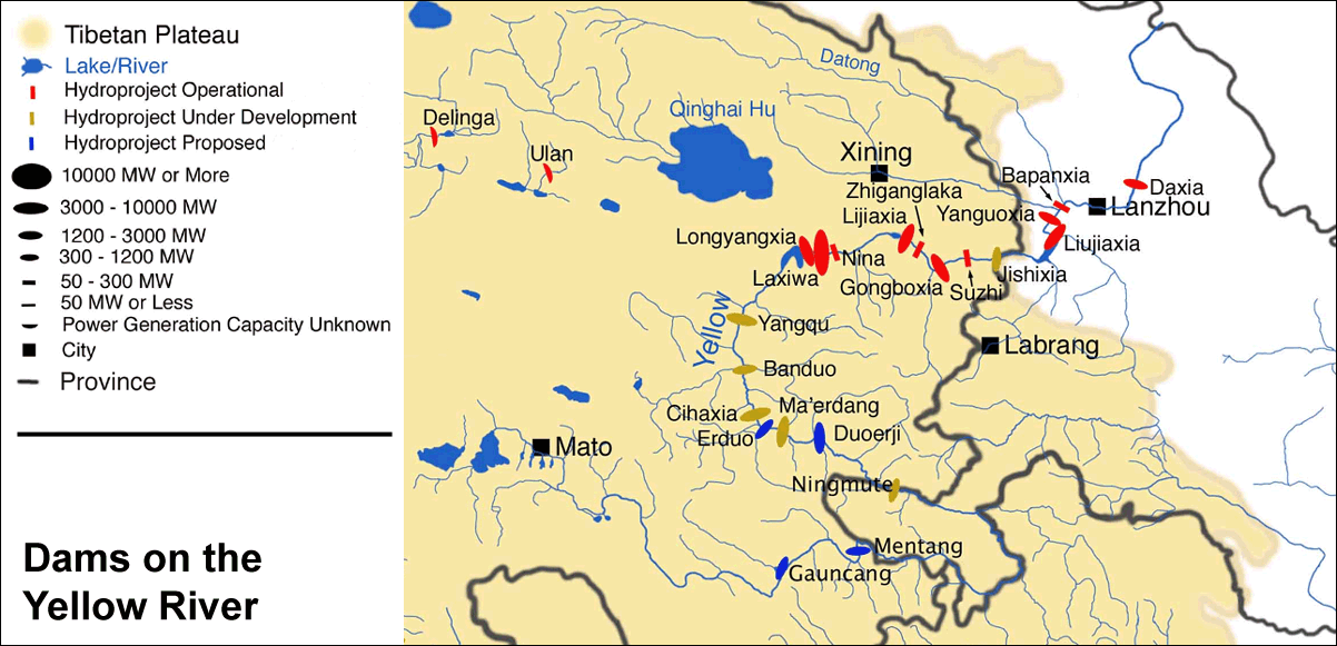
Click map to enlarge